- Products
- Products
- Companies
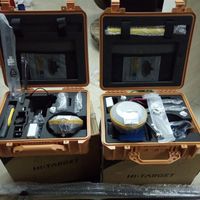
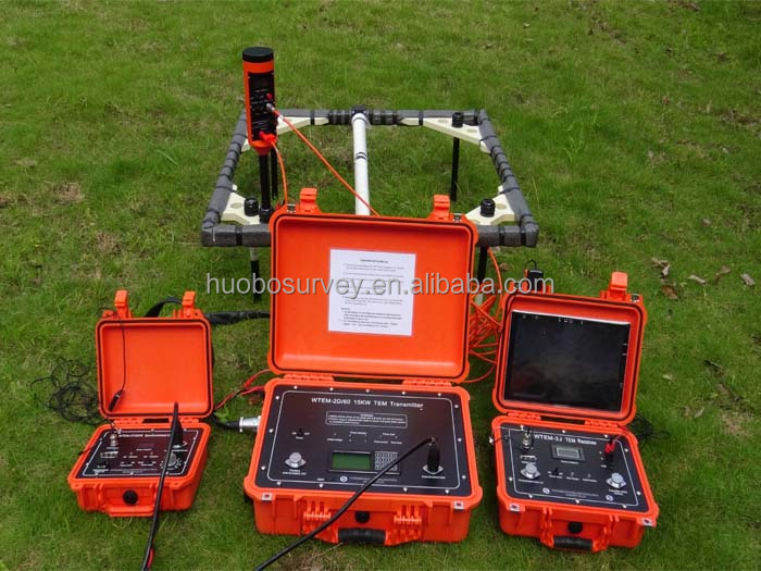
Geophysical Transient Electromagnetic Sounder TDEM Equipment with GPS

-
Supplier: Chongqing Huibo Lab Instrument Co., Ltd. -
Region: Chongqing, China -
Contact: Ms Michelle Li -
Price: $10.00 /piece -
Min. Order: 1 piece
| Measuring range: | Transient Electromagnetic (TEM) | Measuring depth: | From 10 meters to over 1000 meters (30 to 3,000 feet) |
| payment terms: | L/C, Western Union, D/P, D/A, T/T, MoneyGram | Packaging Details: | Export Case to Package Geophysical Transient Electromagnetic Echo Sounder TDEM Equipment |
| brand: | the gold | Origin: | Chongqing, China |
| Warranty: | 1 year | model: | WTO |
| product name: | Transient Electromagnetic Equipment (TEM) | use: | Geothermal resources, groundwater and aggregate deposits |
| Test Range: | Time Domain EM (TDEM) | port: | TDEM equipment for geophysical transient electromagnetic depth sounder shipped from Chongqing to Haiyang |
| Key words: | Transient Electromagnetic Instrument (TEM) | Supply capacity: | 1000 pieces per month |
| type: | Geological Exploration Equipment | accuracy: | Time Domain EM (TDEM) |
| strength: | electronic, 7200w, electronic | Customization support: | Transient Electromagnetic Equipment (TEM) |
| application: | Time Domain Transmission Electron Microscopy Detection Equipment |
Geophysical Transient Electromagnetic Sounder TDEM Equipment with GPS
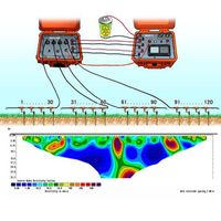
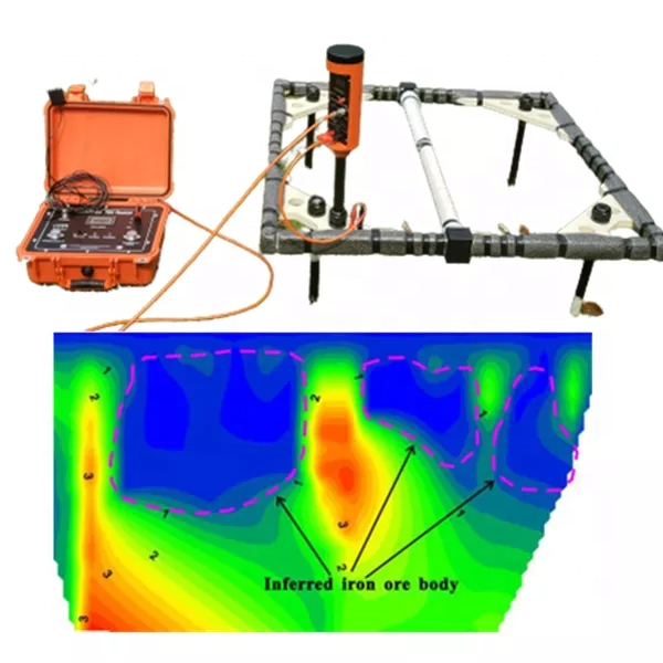
Transient electromagnetic method (TEM) is a rapidly developed instrument for geological exploration using time-domain electromagnetic method (TEM) in recent years. Notable achievements have been made in non-ferrous metals and national defense projects. It can be detected on bare bedrock, cement ground, desert, frozen soil, and water surface. It can effectively detect the thickness of the bed cover. Accurately divide the stratum structure and concealed structure; suitable for shallow groundwater exploration and geothermal water source investigation; groundwater pollution delineation and monitoring; mine goaf detection; can also be used for dam hidden dangers and channel, reservoir leakage and other applications.
application
Geophysical Transient Electromagnetic Sounder TDEM Equipment with GPS
1. Detection of underground aquifers, fault aquifers, coal seam structure and subsidence
2. Underground detection of water storage structures in the mining area and its surroundings and in front of the excavation head
3. To detect the burial depth and the occurrence of good conductive ore bodies, and to detect the ore-forming structure
4. Detection of old kiln and its water content
5. Engineering Exploration and Environmental Exploration
6. Oil and gas field exploration
Standard configuration
Geophysical Transient Electromagnetic Sounder TDEM Equipment with GPS
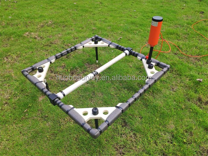
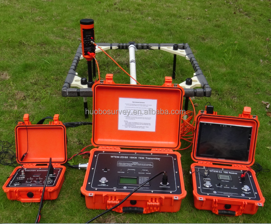
| 01 | WTEM-2J TEM Receiver |
| 02 | WTEM-2D 15KW TEM Transmitter |
| 03 | Win10 Tablet PC Control TEM System Receiver and System |
Optional instruments:
Geophysical Transient Electromagnetic Sounder TDEM Equipment with GPS
PTT-40A Antenna and Adapter
WTEM-2T/GPS synchronization controller
1.1 Main functions and features
Geophysical Transient Electromagnetic Sounder TDEM Equipment with GPS
Operation takes place on the tablet via BlueT.
Improved synchronization controller for WTEM-2T/GPS transmitter: better GPS module and antenna, higher sensitivity, faster synchronization speed, smaller size and lighter weight.
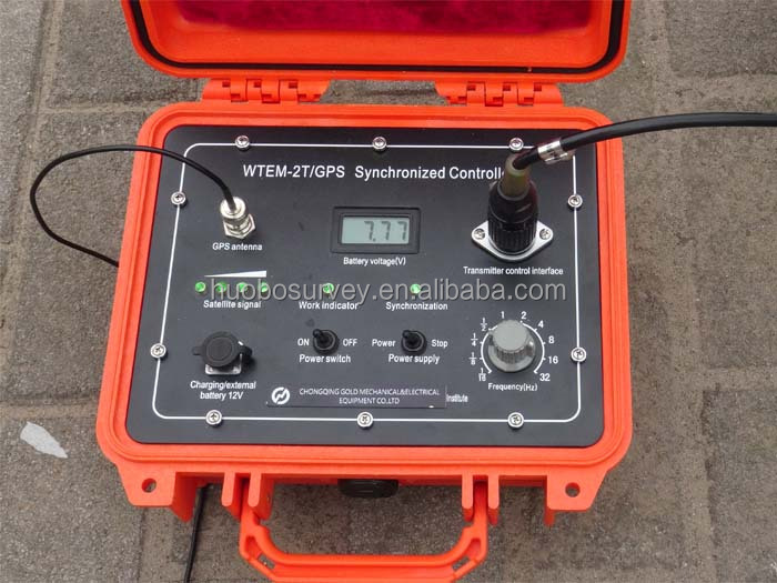
Multiple synchronization methods are supported:
Geophysical Transient Electromagnetic Sounder TDEM Equipment with GPS
a) Cable synchronization
b) GPS synchronization
The latter two synchronization modes require a WTEM-2T/GPS synchronization controller. After startup, it only takes no more than 2 minutes for the transmitter to be synchronized with the transmitter if the satellite signal is good.
High reliability, low power consumption: Exquisite receiver and circuit, sealed and solid mechanical structure ensure high reliability, low power consumption and easy operation.
Wide detection depth range: WTEM-2D transmitter can help to conduct medium or deep detection from tens of meters to thousands of meters.
Remote Control: Pocket PC and BlueT wireless communication technology enable the WTEM-2J receiver to operate within 10 meters, such as setting parameters, starting measurement, transmitting and displaying measurement results.
High anti-interference performance: program control filter gives accurate power frequency; besides, data stacking and software filtering are also good for this performance.
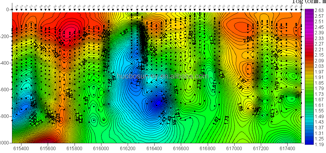
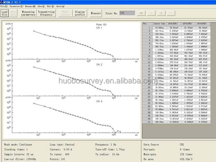
Multi-channel, high measurement accuracy: the operator can set the number of channels, linear or logarithmic; the crystal oscillator realizes timing, and the time-to-depth ratio is stable and accurate. The sampling window is arranged reasonably, and the real underground structure can be imaged. It provides a reference for complex geological problems.
Short turn-off time: The transmitter supports a quick turn-off function, which can extend the shallow detection range. The short shutdown feature provides the software with an accurate shutdown time to give accurate data.
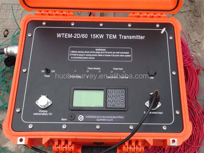
WTEM-2D/60 15KW transmitter (standard configuration) specifications:
Geophysical Transient Electromagnetic Sounder TDEM Equipment with GPS
| emission voltage | ≤250V |
| Transmission current | ≤60A |
| power frequency | 0.0625Hz, 0.125Hz, 0.25Hz, 0.5Hz, 1Hz, 2Hz, 4Hz, 8Hz, 16Hz, 32Hz |
| Synchronously | External synchronization (cable, GPS) |
| power supply | Built-in 12V9.6Ah lithium battery (or external 12V power supply) lasts for more than 8 hours |
| Turn off delay time | 1µs~1000µs |
Geophysical Transient Electromagnetic Sounder TDEM Equipment with GPS
Geophysical Transient Electromagnetic Sounder TDEM Equipment with GPS
Geophysical Transient Electromagnetic Sounder TDEM Equipment with GPS

-
2 in 1 Laptop Motherboard DDR4 DDR3 Memory Slot Memory LED Diagnostic Analyzer Test Card

-
High Strength Compression Tear Testing Machine Universal Material Testing Machine Mechanical Tensile Testing Machine
-
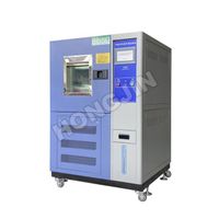
Programmable Environmental Climate Chamber Humidity Temperature Test Chamber Climate Temperature Test Chamber Humidity Test Equipment Price
-
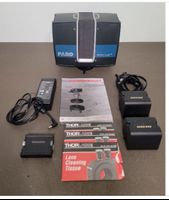
Faro Focus S350 3D Laser Scanner w/ Accessories, Case And Extra Batteries
-
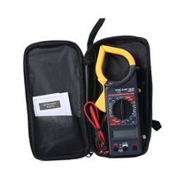
Digital clamp multimeter high-precision clamp meter to measure voltage and current clamp multimeter DT266
-
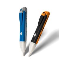
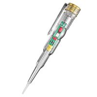
1AC-D non-contact electric measuring pen 90-1000V induction electric pen electroscope electrician electricity indicator
-
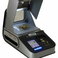
Home Delivery Promotion Thermo Scientific-Niton DXL-XRF Precious Metals Analyzer
-
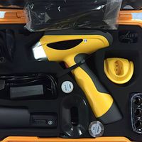
Best Price X-ray Fluorescence Spectrometer Metal Element Testing Handheld XRF Explorer 5000 EXP5000 Analyzer
-
2022 best-selling transparent electric screwdriver test pen multi-functional induction test pen
-
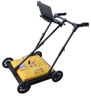
Ground penetrating radar
Other Products
-
$50.00 / set
-
$450.00 - $500.00 / set
-
$100.00 / set
-
$5.00 - $10.00 / set
-
$1000.00 / set
-
$1.00 / set
-
$5.00 / set
-
$0.10 - $0.20 / set
-
$1.00 / set
-
$0.50 - $1.00 / set