- Products
- Products
- Companies
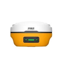
TRIMBLE BOARD FOIF A90 GNSS RECEIVER SURVEY HANDHELD GPS RTK

-
Supplier: Shenzhen Pengjin Technology Co., Ltd. -
Region: Guangdong, China -
Contact: Mr PJ Manager -
Price: $5800.00 /set -
Min. Order: 1 set
| Brand Name: | FOIF; | GNSS positioning: | 0.25m / 0.50m; |
| Package Type: | 40*44*43cm 14.3kg 142*23*12cm 4.1kg; | Single gross weight: | 17.5 KG; |
| Satic Positioning: | 3mm / 3.5mm; | Initialization time: | typically <8 seconds; |
| Real-time positioning;: | 10mm/15mm; | Selling Units: | Single item; |
| Wireless connections: | 3.5G WiFi, Blueteeth, GPRS/EDGE,; | Satellite: | GPS, GLONASS, SBAS, L1,L2; |
| Single package size: | 60X55X50 cm; | Frequency: | Dual Frequency gnss; |
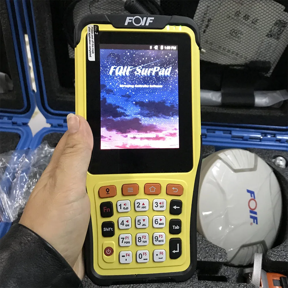
| Software: | surpad 3.0; | Network RTK: | 10mm/15mm; |
| Place of Origin: | Guangdong China; | Package Preview: | https://sc02.alicdn.com/kf/HTB15VxAelaE3KVjSZLeq6xsSFXaj.jpg_640x640.jpg; |
Trimble BOARD FOIF A90 GNSS RECEIVER SURVEY HANDHELD GPS RTK
NEW GENERATION A90 RTK GPS Receiver
With a hi-tech, fully integrated design, the conveniently sized A90 is one of the most flexible device for any gps measuring task. Built-in Linux3.2.0 operating system, pre-loaded multiple smart applications such as tilt surveying, electronic bubble calibration, NFC and voice DIY.
The A90 Plus RTK GPS system provides surveyor industry-leading GPS operation
Multi-constellation Tracking
555 channels (STANDARD)
NGS approved full-wave GNSS antenna
Supports GPS, GLONASS, GALILEO, BDS, SBAS
Supports a wide range of satellite signals
A large receiving area designed for multipath mitigation
Air dielectric is light and stable
Smart Application
Offers tilt survey with a maximum tilt angle of 30 degrees
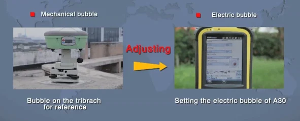
Supports electronic bubble
Intelligent voice assistance guides field operations. Voice can be DIY
Standard Rinex data and raw data recorded
simultaneously
Multi-network Connection
Supports GPRS, GSM and WCDMA
Supports WIFI

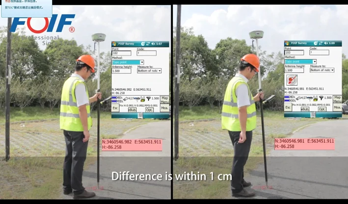
GPS RTK MEASURING IN THE CITY WITH BUILDING SURROUNDED, WHICH IS ALSO ABLE TO GET A FAST FIXED SOLUTIONS, THIS DEVICE IS GETTING GREAT PERFORMANCE.
| FOIF A90 GPS RTK SYSTEM data sheet | |
| GNSS Singal Track | 555/394 channels |
| GPS L1,C/A,L2E, L2C, L5 | |
| GLONASS L1,C/A,L1P, L2,C/A ,L2P,L5; | |
| BDS B1 B2 B3 | |
| SBAS(WAAS,MSAS,ENGOS)L1,C/A,L5; | |
| GLOVE-A\B L1 BOC(CBOC)-E5A/B, E5AltBOC | |
| RTCM2.3, RTCM3.X, RTCM3.2, CMR, CMR+ | |
| Receiver accuracy | |
| Static post processing accuracy | H:±2.5mm+1×10 ·D;V:±5.0mm+1×10 ·D |
| RTK Positiong accuracy | H: ±8mm+1×10 ·D; V:±15mm+1×10 ·D |
| Code different positioning accuracy | 0.45m |
| Single point positioning | 1.5m |
| DATA LINK | |
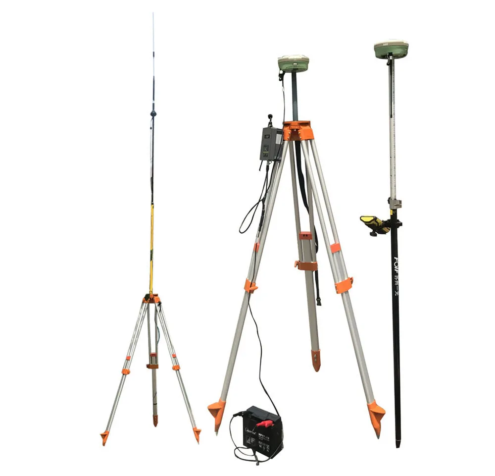
| TX/RX Radio | Internal radio RX/TX 5KM-10KM |
| External radio | FOIF external radio Rx & Tx(FDL-5, 2/35W selectable) 50KM WORKING RANGE |
| WIFI | WIFI connect controller configuration |
| 3G/4G | GSM/GPRS/EDGE (class 10) Quad-band -GSM/GPRS: 850/900/1800/1900MHz band CDMA(Optional) |
| OTHERS | |
| Battery | 7.2V 3400mAh 2pcs standard; Indicable for volumn Compatible with controlle battery; |
| Display | 4 led light; 1 button key; Voice |
| NFC Survey | Internal electrical Bubble; Capacity for second general NFC Survey |
| Memory | 4G |
| Interface | RS232*2 / Bluetooth *1 / USB*1 SIM *1 / TF*1 / Internet *1 |
| Anti-dust & Anti-water | IP68 |
| Temperature | working model:-40℃~+80℃ store model:-55℃~+85℃ |

FOIF A90 GPS RTK TRAINING IN SHENZHEN STREET
FOIF Geomatics CAD
Main functions include:
- DWG file format, compatible with AutoCAD Integrated transformation and grid system computations
- Full 3D least squares adjustment, blunder detection, graphical ellipse display
- DTM contouring/Modeling volumes/3D rendering
- Site Design: Ponds, ditches, stockpiles and slopes Road Design: horizontal and vertical alignments, cross sectional templates
- Completely customizable user interface
-Toolbars - can be arranged with "drag and drop" functionality
-Menus - can be re-organized with our graphical menu editor
-Screen - items can be turned off for more
graphics area
-Layout - of command window - top or bottom Reporting, - exporting and printing
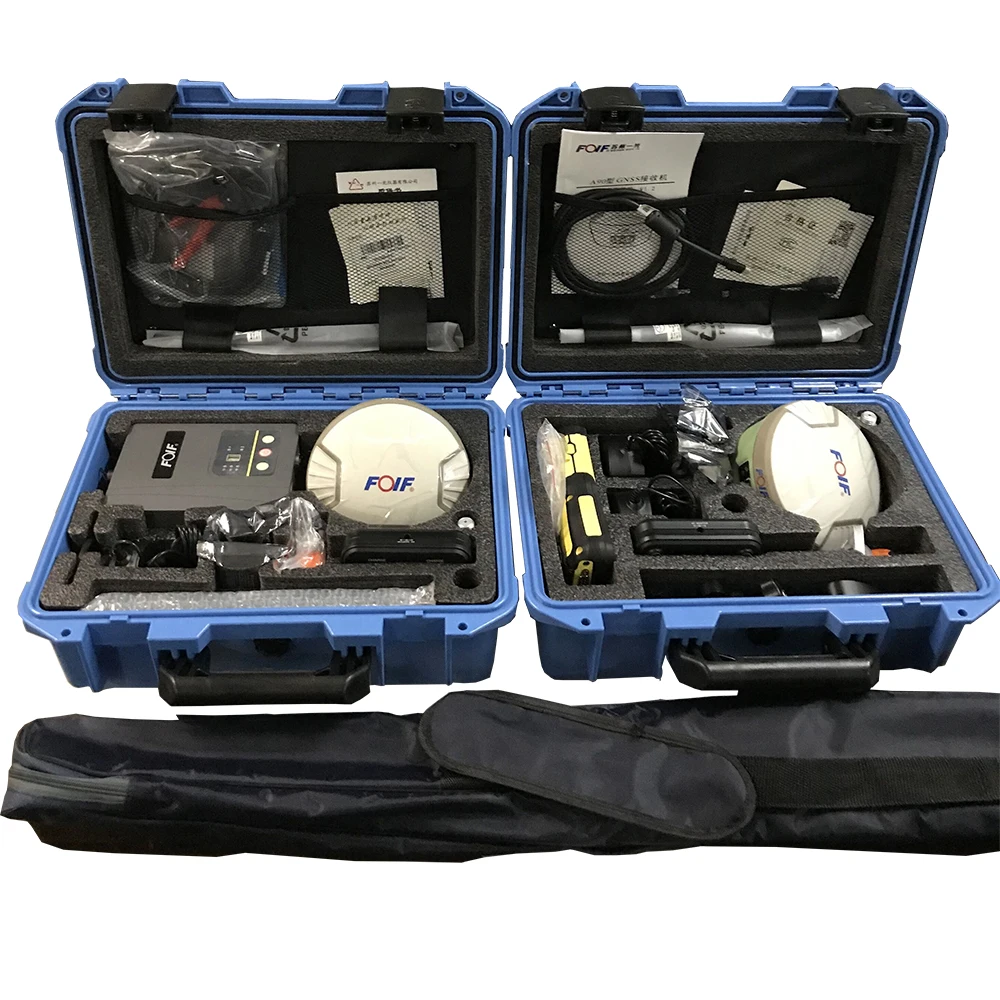
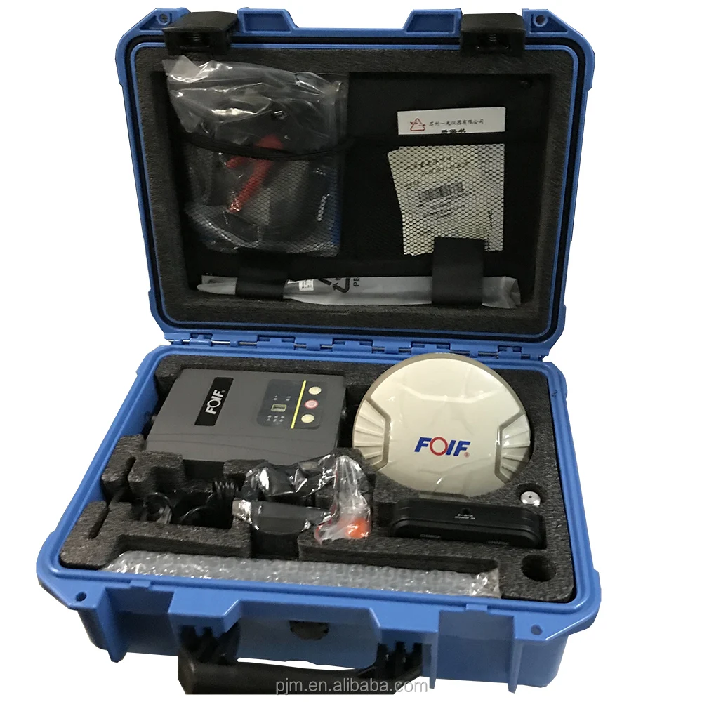
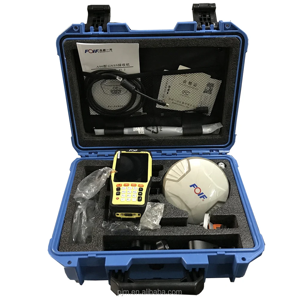
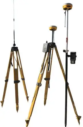
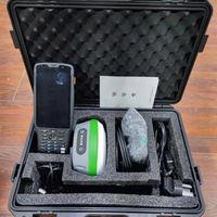
A90 GNSS GPS RTK RECEIVER PACKING PICTURE:
SIMILIAR HOT SELLING GPS RTK UNISTRONG G970II


-
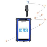
HUGEROCK G71M High Performance GNSS Surveying Instrument GPS Drone RTK Industrial Rugged Android Tablet 7 Inch

-
SK F TKSA 51 laser axis alignment system
-
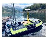
Portable underwater terrain survey won the bid for the price of the unmanned marine vehicle iBoat BS1 unmanned surface vehicle
-
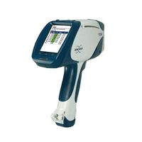
German Bruker Handheld Spectrometer/Handheld Alloy Analyzer S1 TITAN/TRACER 5g
-
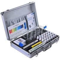
New design drinking water and swimming pool water quality analysis kit / water quality analyzer test kit
-
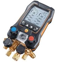
Testo 550s Testo 557s Smart Kit with 2 Digital Multimeter Metering Valves
-
Newest Gnss Receiver Measuring Instruments Gps Gnss Hi-Target Vrtk V5 Gnss
-
New Ivoclar Vivadent Programs P710
-
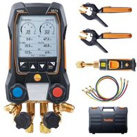
Smart Testo 557s Smart Kit with 2 digital multimeter valves
-
SunNav S26 GPS RTK Other Test Instruments GPS rtk 970 E91 Geographic Equipment S26 RTK GNSS

Other Products
-
$2500.00 - $3500.00 / unit
-
$3000.00 / unit
-
$2500.00 / unit
-
$3500.00 / set