- Products
- Products
- Companies
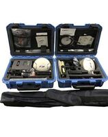
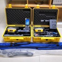
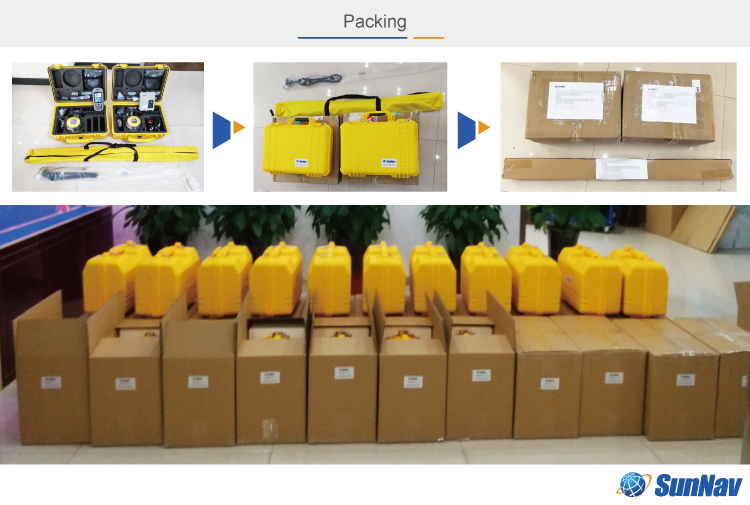
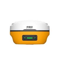
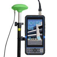
SunNav S26 GPS RTK Other Test Instruments GPS rtk 970 E91 Geographic Equipment S26 RTK GNSS

-
Supplier: Sunnav Technology Co., Ltd. -
Region: Tianjin, China -
Contact: Mr Andy Wang -
Price: $950.00 /piece -
Min. Order: 1 piece
| Warranty: | 1 year | Supply capacity: | 3000 sets per month |
| channel: | 432 channels based on Nebulas-II | Battery: | 6600mAh, 3.6V, working time more than 12 hours |
| Li-ion battery capacity: | 10200mAh | place of origin; place of origin: | Tianjing, China |
| QZSS: | L1,L2,L5 | Customization support: | OEM production |
| Global Positioning System: | L1,L2 | brand: | sun navigation |
| Packaging Details: | World standard export packaging | Beidou: | B1,B2 |
| payment terms: | L/C, Western Union, D/P, D/A, T/T, MoneyGram, Paypal | External power input: | 9V DC to 36V DC |
| Galileo: | E1,E5a,E5b | Real Time Kinematics (RTK): | Horizontal: 8 mm + 1 ppm RMS Vertical: 15 mm + 1 ppm RMS |
| Glonass: | L1,L2 |
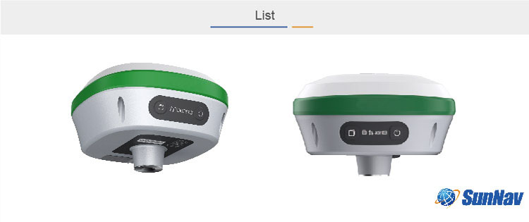
S26 GNSS RTK Receiver GPS Geodetic Instrument

describe
The S26 GNSS receiver removes the portability barrier without sacrificing performance. It features full GNSS technology and provides best-in-class GNSS signal tracking even in harsh environments, enabling GNSS surveys beyond usual limitations. GNSS incorporates the latest innovations such as inertial modules that provide automatic polar tilt compensation in a very compact design.
feature
• The power of GNSS+IMU RTK technology
Built-in inertial navigation module, click to measure. As long as the poles are aligned,
Accurate coordinates can be measured even when the rod body is tilted. The measuring point efficiency is
Increase by 20%, pledge efficiency increased by 30%.
• integrated design
Built-in Bluetooth, radio, storage, positioning, inertial navigation, antenna and other modules to meet various needs
Measurement work needs
• Built-in UHF radio
Built-in low-power transceiver integrated RF module, which can realize automatic switching between mobile phones
station and base station
• Expandable to dual antennas
The built-in integrated positioning and heading board can be connected to an external antenna to achieve high
Precise Heading Applications
• Full constellation multi-band
Fully support BDS, GPS, GLONASS, Galileo systems, adapt to various complex and harsh environments,
Guaranteed centimeter-level positioning accuracy
• Large capacity and long battery life
The built-in battery with a capacity of up to 10000mAh can achieve more than 14 hours of battery life
Battery life ensures long-term operation in harsh outdoor environments
• Strong compatibility
Adapt to transparent, TRIMTALK, South and other communication protocols
• NFC connectivity
Equipped with NFC chip, users can easily connect S12 receiver and data collector with only one
Touch, no need to search for pairing.
• Interchangeable between two operating modes
Base station mode and rover mode can be switched freely according to needs

| GNSS performance | |
| channel | 432 channels based on Nebulas-II |
| Global Positioning System | L1,L2 |
| Glonass | L1,L2 |
| Galileo | E1,E5a,E5b |
| Beidou | B1,B2 |
| QZSS | L1,L2,L5 |
| GNSS accuracy | |
| real-time Kinematics (RTK) |
Level: 8 mm + 1 ppm RMS Vertical: 15 mm + 1 ppm RMS Initialization time: < 5 s initialization Reliability: > 99.9% |
| post processing Kinematics (PPK) |
Horizontal: 2.5 mm + 1 ppm RMS Vertical: 5 mm + 1 ppm RMS |
| post processing stationary |
Horizontal: 2.5 mm + 0.5 ppm RMS Vertical: 5 mm + 0.5 ppm RMS |
| positioning rate | Default 1 Hz, maximum 20 Hz |
| time to first fix | Cold start: < 25 seconds Hot start: < 10 seconds Signal reacquisition: < 1 s |
| RTK Tilt - Compensation | Tilt angle 0~60°, tilt precision 25mm (within 30° accuracy) |
| hardware | |
| Dimensions (LxWxH) | 140mm x 140mm x 88mm (5.5 inches x 5.5 inches x 3.5 inches) |
| weight | 1.03 kg (2.27 lbs) |
| environment | Operating: -45°C to +75°C (-49°F to +167°F) Storage: -55°C to +85°C (-67°F to +185°F) |
| humidity | 100% condensing |
| ingress protection | IP67 waterproof and dustproof, Protection against temporary immersion- to a depth of 2 m |
| Shock | Survive a fall from a 2-meter pole |
| tilt sensor | Pole Tilt Calibration-Free IMU compensation. Immunity to magnetic interference. |
| front panel | 4 LED indications 2 physical buttons |
| communicate | |
| Bluetooth | v4.0, backward compatible with BT2.x |
| port | 1 x 9 PIN aviation plug, including power supply Power, COM RS232, Configuration, RS232. 1 x UHF radio antenna interface |
| Built-in UHF radio | Standard internal Rx/Tx: 410 - 470 MHz/840 MHz Transmitting power: 0.5 W to 2 W Protocols: Transparent, TT450S, Trimtalk, TRMMARK3 |
| external radio | Frequency: 410-470MHz Transmission power: 35W Working range: 15-20Km |
| Data Format | Link rate: 9600 bps to 460800 bps Range: Typical 5km to 8km RTCM2.x, RTCM3.x, CMR |
| data storage | 8GB memory |
| electric | |
| energy consumption | 5W (depending on user settings) |
| Li-ion battery capacity | 10200mAh |
| operation hours Built-in battery |
20h (Land Rover) 10h (baseline) |
| External power input | 9V DC to 36V DC |
| energy consumption | AS Rover < 4.0W As base <10.5W |


-
HUGEROCK G71M High Performance GNSS Surveying Instrument GPS Drone RTK Industrial Rugged Android Tablet 7 Inch

-
SK F TKSA 51 laser axis alignment system
-
Portable underwater terrain survey won the bid for the price of the unmanned marine vehicle iBoat BS1 unmanned surface vehicle
-
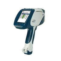
German Bruker Handheld Spectrometer/Handheld Alloy Analyzer S1 TITAN/TRACER 5g
-
New design drinking water and swimming pool water quality analysis kit / water quality analyzer test kit
-
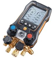
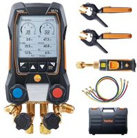
Testo 550s Testo 557s Smart Kit with 2 Digital Multimeter Metering Valves
-
Newest Gnss Receiver Measuring Instruments Gps Gnss Hi-Target Vrtk V5 Gnss
-
New Ivoclar Vivadent Programs P710
-
Smart Testo 557s Smart Kit with 2 digital multimeter valves
-
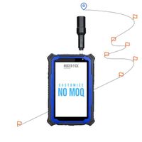
HUGEROCK G60S rugged pda gnss rtk antenna waterproof android ip67 smart 4g industrial security


Other Products
-
$1800.00 / unit
-
$1800.00 / unit